
Fond du Lac Neighbor Sources
No official roll names every person on a Fond du Lac block. GIS defines parcels and civic geography. Property records connect parcels to owners and mailing addresses. Deeds explain transfers. MyVote confirms a matched voter's own record, while broader voter-file requests follow Wisconsin rules and remove protected data. Historical directories show an earlier block, and civic groups publish contacts or community history rather than private household rosters.
| Source | What it shows about a block | Access channel |
|---|---|---|
| County GIS | Parcel boundaries, address numbers, nearby lots, zoning and district layers | Free viewer; click, draw, buffer, and selected-data export |
| Property search | Owner, mailing address, site address, tax links for a parcel | Free search; property card and tax links |
| Deed index | Transfer parties and legal description for each lot | LandShark, index books, and Register of Deeds terminals |
| City property request | Selected permit, zoning, code, occupancy, fire, and site-plan records | $50 per property request; ten-business-day estimate |
| Voter channels | A matched personal record or permitted public-file fields | MyVote self-lookup; written file request with redactions |
| Criss-cross directories | Historical occupants listed by street or address | Seefeld Room and ResCarta; dates vary |
| Civic pages | Community boundaries, public contacts, activities, and history | Public association or city website; no private roster assumed |
Use the GIS and property roll for the present block, then choose a second source that answers a specific question. An owner's tax-mail address can be elsewhere. A deed party may never have occupied the property. A directory is a dated historical claim, not a present list of Fond du Lac neighbors.
Map a Fond du Lac Block
The Fond du Lac County Land Information GIS offers the most precise official route from one address to nearby parcels. Search the site address, select its polygon, and decide whether “nearby” means touching lots, both sides of the block, or a stated radius. Record that choice so another reader can repeat it.
- Search a site address or the 16-digit parcel number with dashes, then select the subject parcel.
- Click adjacent polygons, draw around the block, or set the buffer distance in feet.
- Open the data table for selected parcels and inspect each Property Card or Tax Bill link.
- Compare site address, owner, secondary owner, mailing address, municipality, and legal description.
- Export selected rows to PDF, Excel, RTF, or CSV when a dated working list is useful.
The full named-street workflow belongs on the Fond du Lac street directory page. Here the aim is the immediate ring around one point, with a clear boundary and date.
Buffer Fond du Lac Neighbor Parcels
The county guide's buffer tool selects parcels that intersect a user-set distance around the chosen parcel. That is stronger than eyeballing which shapes seem close. A long rear lot, corner parcel, alley, or irregular shoreline can make visual adjacency misleading. Save the distance and map date alongside the selected table.
The tool can also work with zoning or polling-location selections. County layers include city, township, and village zoning; school, fire, sanitary, ambulance, census, and supervisory districts; municipal boundaries; roads; address numbers; and current orthophotography. One street can cross a district or municipality without looking different on the ground.
GIS output remains reference-only. The parcel data draws from deeds, subdivision plats, and certified survey maps, but the county warns that it is not a survey or legal determination. Use the Register of Deeds when a boundary or title point matters.
Practical tip. Define the radius first, then export the selected rows so the meaning of “nearby” does not shift during research.
Date Fond du Lac Block Records
Current-record labels matter when identifying your neighbors. Fond du Lac County's Parceljoin2025 metadata was published January 14, 2026, and says parcel information is current through December 31, 2025. It also repeats that the data is for reference and is not a survey. Tax rolls update on their own schedule, while deeds can record later transfers.
The county parcel metadata page should be checked before presenting an exported block table as current. If a transfer occurred after the dataset cutoff, follow the parcel's document reference to the Register of Deeds. Call Land Information at 920-929-3135 when the viewer status or dataset vintage is unclear.
Note: Put the source date next to every block list, because a recent deed may post after a parcel dataset snapshot.
Read Fond du Lac Owner Fields
Open each selected parcel rather than treating an export as a list of occupants. The property card can link the owner and secondary owner to a parcel, site address, municipality, deed reference, and tax record. The tax mailing address is meant for notices. It may be another city, a post office box, a business address, or a representative's address.
- Parcel
- A mapped unit of land with a county identification number.
- Site address
- The physical address assigned to the parcel.
- Mailing address
- The destination for owner tax mail, which may not be the owner's home.
- Legal description
- The formal lot, block, subdivision, or tract wording used to identify land.
County property data does not reliably name renters, children, relatives, or all other household members. Detailed building facts can also remain with the local assessor. State exactly “recorded owner” when that is all the source supports.
Fond du Lac Voter Boundaries
MyVote Wisconsin is not a public block browser. Name mode requires first name, last name, and birth date. Address mode uses street address, optional unit, city, and ZIP to match a voter's own record. A successful match can provide registration and civic-service information, but it does not reveal ballot choices.
A broader registration list may be requested in writing under Wis. Admin. Code EL §3.50 and the cited Wisconsin election and public-records laws. Protected elector data is withheld. The rule lists a $25 electronic base charge, $5 for the first 1,000 records and each additional 1,000, with a stated maximum of $12,500. Custom pricing can vary. Ask for a clear geography and date rather than assuming a public file mirrors a GIS buffer.
City registration questions go to the Fond du Lac City Clerk at 920-322-3430. County election questions go to the County Clerk at 920-929-3000. Neither route turns MyVote into a list of all Fond du Lac neighbors.
Fond du Lac Community Contacts
Public association pages describe shared places and offer contact routes. They do not prove who lives at a parcel. No official citywide neighborhood-association registry, block-watch roster, congregation roster, or searchable resident-member directory was found. Use these organizations for public history, planning, events, and questions within their stated scope.
Lake de Neveu Association
Lake de Neveu Lake Area Homeowners Association
Public lake history and mission covering safety, quality of life, wildlife, and the environment. No member directory was located.
Downtown Partnership
Downtown Fond du Lac Partnership
131 South Main Street, Suite 101
920-322-2006
Public downtown, preservation, and development contact.
Community Development
Fond du Lac Community Development
Planning, zoning, preservation, and proposed-action notices. Call 920-322-3440 for the public-notice list.
The Lake de Neveu source shown below illustrates the community-history layer.
Open the official Lake de Neveu association page.
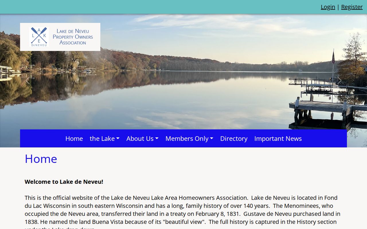
The page traces the area's Menominee land transfer in 1831 and Gustave de Neveu's purchase in 1838. That history adds place context, but it should never be converted into assumptions about current member households.
Historic Fond du Lac Neighbors
For an earlier block, switch from current parcel ownership to a dated criss-cross directory. The research identifies a 1978 Fond du Lac criss-cross lead, while older city directories may include street and avenue guides. Search the address section first, then verify each name in the alphabetic section. Occupations, spouse or widow notes, and business addresses can help distinguish people with similar names.
The Seefeld Local History Room and Winnefox ResCarta hold directory, newspaper, plat, cemetery, yearbook, map, and local-history material. Coverage is collection-specific. Old entries may use initials, German and English variants, abbreviations, or landmark-based addresses. Preserve the printed form in research notes.
Historical blocks also change through annexation. Town of Fond du Lac parcel-map annotations document 1999 and 2002 annexations with ordinance and recorded-document numbers. Search those legal links when the same land appears under different municipal labels.
Official Fond du Lac Records Win
Commercial neighbor tools can merge names, phone data, and addresses from many dates without making the source or update cycle clear. Official systems are narrower, but each fact has a custodian, a record date, and a correction path. That makes them better for a careful block check.
| Question | Official record route | Commercial compilation limit |
|---|---|---|
| Who owns this parcel? | County property record, then deed | May repeat an old owner without the instrument |
| Which lots fall in the radius? | GIS buffer and selected table | Radius method and parcel geometry may be hidden |
| Who lives in the household? | No complete official public list | May blend relatives, prior occupants, and mailing records |
| Which civic district applies? | County GIS layer or election custodian | May not state its boundary date |
Correct parcel errors with Land Information or the relevant assessor, recording issues with the Register of Deeds, and voter-record errors with the municipal clerk. A compiled profile cannot change any official source.
Protect Fond du Lac Neighbors
Renters and household members are not reliably indexed in county land records. Utility accounts, delivery records, and DMV address data are not public neighbor-directory sources. Voter files omit protected fields and never reveal ballot choices. Wisconsin Safe at Home participants may use an assigned address and receive confidential-elector and court-record protections.
Use public information to understand a block, make a courteous connection, research local history, or confirm a parcel involved in a personal matter. Do not publish a protected address, treat owner mail as proof of occupancy, or use repeated contact to frighten someone. Wisconsin stalking and harassment laws apply regardless of where a name was found.
Lawful use. Fond du Lac neighbor records support civic and personal research. They never authorize surveillance, threats, harassment, or exposure of protected people.